Wednesday, January 31, 2007

Shvil Yisrael -- Rabin Park

Is it just me, or is everything in this country named "Rabin"? I'm surprised we haven't yet become the "State of Rabin."

We had agreed to take The Oldest Teen to his base on Sunday morning. Despite the prohibition on soldiers hitchhiking, every time we go out we load up our car with soldiers, so why not do it once for our own boy? Everything was planned, I had a nice walk planned out near Nitzanim, and then he comes home--he's been assigned, for the week, to the big army base at Tzrifin. Great. Who wants to walk in Rishon LeZion?

The day was beautiful when we left the house, horribly foggy by the time we got to the base. But since we were out, anyway, we decided to continue toward Beit Meir and see if the weather picked up. By the time we got to where we'd left off last the sun had come out, and we set off in the direction we'd meant to go last time, if only The Spouse didn't have a lousy sense of direction.

Israel National Trail markings are few and far between on this route. If you don't have a book with turn-by-turn instructions with you, just remember that you have to pass mishlat (fortified height) 16 and 21 to stay on the Trail.
100_1565
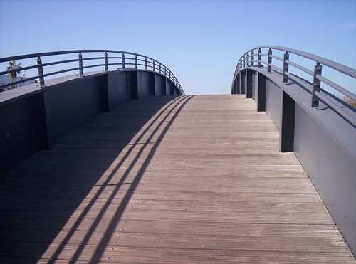
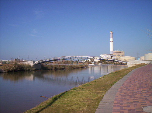
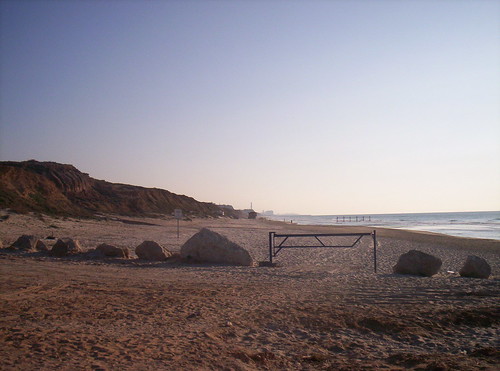
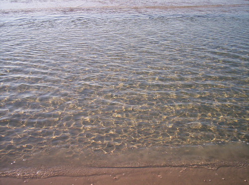
The views here are very different from those on the beach walks. Hard to believe we're less than an hour away from there. The more I walk this country, the more I realize how much is compressed into this little slice of land.
100_1568
100_1613

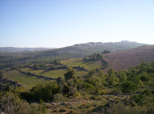
Most of this walk is along the path used to gain the hills around Jerusalem. The historical aspect (the Palmach's fight to gain control of the fortified high ground, in Operation Maccabi, May 1948) is well-signed. The trail--less well signed.
100_1562
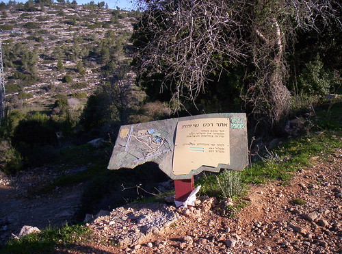
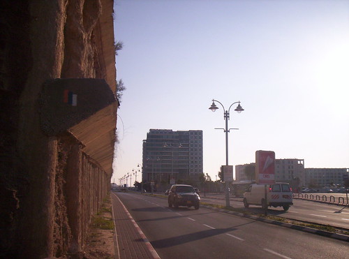
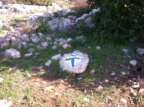
Here's why a guidebook is so important. See any National Trail markings here? (Those would be blue, white, and orange.)
100_1571
Overlook to the right, 4x4 path to the left. The overlook is probably on the trail, right? Wrong. When you get to this sign, you'll start to follow the green and white 4x4 trail. Occasionally there will be National Trail markings, but not often. As long as you're on track towards 16 & 21, you're in the right place, not that anyone will tell you.
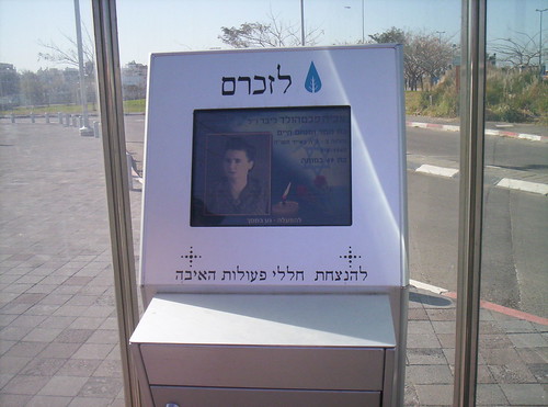
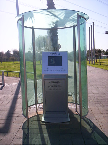
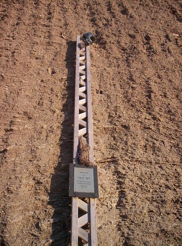
After a nice little nature hike you'll reach mishlat 16, where you'll find a nice example of our national product--a memorial to the fallen, in this case, Palmach fighters.
100_1575
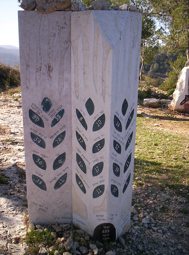
It felt odd, a year and a half after the expulsions from Gush Katif, to see a marker memorializing (among others) 10 Palmach fighters who died trying to defend Kfar Darom in the fight for independence, and it made me think how different history would have been had they managed to hold on to the village back then.
We thought this was the difficult part of the trail--there were some somewhat steep uphills. The Spouse and I joke that we're doing "National Trail for the old and enfeebled," but this section is not for that demographic; we certainly couldn't see bringing his 86 year old mother here, for example.
100_1585
Continue up the path, following the green and white markings, until mishlat 21.
100_1588
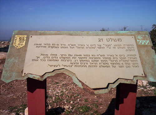
Here the trail gets more complicated, because instead of following the signs to more historical markers, you have to go behind the memorial area, behind the firing stand (for some reason, exceptionally well marked)
100_1593
and down between some rocks on what barely looks like a path. How a 4x4 is supposed to manage this part is beyond me.
For the next hour or so I only took pictures looking uphill after we'd scrambled down. If I'd had to look all the way down from where we were at the top of the mountain, I'd have been too chicken to go on.
100_1596
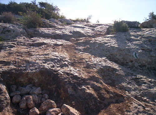
Do you really think a 4x4 could do this path?
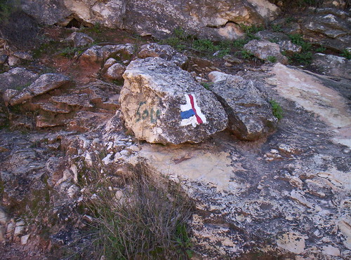
Finally an Israel National Trail marking, telling you to continue on the green path. We were getting hot and tired, so we decided to cut across the blue path, back to the red, which would circle around to where our car was parked.
100_1600
No one, not even the guidebook, bothered to inform us that if green and white meant "barely passable for a 4x4," blue and white meant "barely passable by a mountain goat."
100_1611
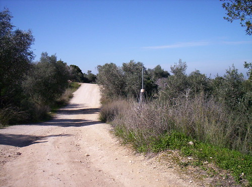
(See that vaguely light brown dirt path? That's the path to take. It's very well marked, which is good, because the trail itself is very poor, and tends to become slippery rock at the least provocation.)
The red trail! A Jeep trail! Probably passable! Yay!
100_1609
100_1614

The specs: From the Beit Meir hen houses to mishlat 21
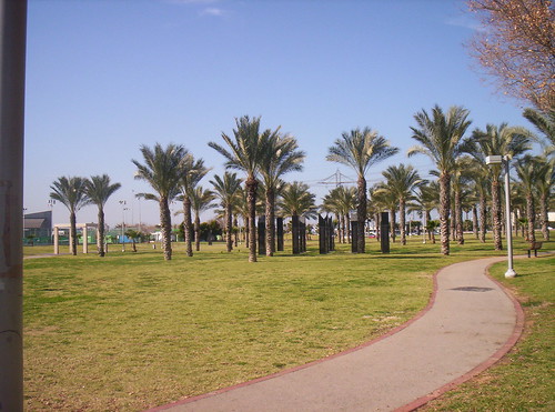
Parking: Free parking at KKL's Rabin Park (space for 4-5 cars or 3 buses)
Return: Foot, baby. Bring a walking stick.
Difficulty Level: The trail itself is a bit steep in places, but manageable. The shortcut to make the walk circular is not recommended for anyone with a fear of heights or problems with balance. Wear good walking shoes.
Potential hazards: Steep rocky paths, poor signage, loose rocks.

Monday, January 29, 2007

Shvil Yisrael -- Tel Aviv to Arena Mall

So, it looks like all I do is walk, knit, and work? Um--yeah, and your point is?

Last Thursday we finished off the Tel Aviv section of the trail. We had started it, as a family, back in April of 2005, but since the kids are all over the place now (the Oldest Teen in the army, the Middle Teen in Hadera, the Youngest Teen sometimes agreeing to come home), we decided to finish it off by ourselves.

Warning: This is going to be picture heavy, because the trail signage sucks, and not in a good way, in Tel Aviv.

We took up where we left off last, in the Yarkon Park in Tel Aviv.
100_1388
Based on the marking, you'd think you should go over the bridge, right? Well, the bridge was pretty, with all its cut out shapes, so it was a nice detour.
100_1391
But if you're doing the trail, take the path *under* the bridge to continue. Go along the path until you get to the memorial for fallen Tel Aviv residents (this country specializes in memorials).
100_1396
Here's another example of bad signage. The path, you'll notice, runs on the extreme left of the picture. The sign to turn is on the right.
100_1436
Usually signs, especially ones so important, are just on the side of the trail, not hidden. Again--if you're doing the trail, the turn onto the streets of Tel Aviv is just past the tennis courts, *before* the boating and rowing center. *Before,* I said--not after. But having missed the turn, we did get to see some pretty sights:
100_1417
100_1426
Once we realized we were lost and found our way back to the trail, we exited onto Rokach Blvd. On the other side of the memorial are two computer kiosks, one to Tel Aviv residents killed in terrorist actions, back to before the establishment of the state:
100_1438
The kiosk on the other side of the park is for Tel Aviv residents who fell in battle. Despite the fact that The Spouse used to collect obits of people with the same name as his, he wouldn't let me take a picture of the screen devoted to the soldier with his name who was killed in Khan Yunis on June 5, 1967.
100_1444
When you get to the corner of Rokach and Ibn Gavirol, you won't find another missing marking, but make a left turn onto Ibn Gavirol. Just across Rokach you'll see a marking telling you to continue up Ibn Gavirol, so you know you're on the Trail.
100_1449
Continue up Ibn Gavirol to Agnon. Here there is a marking telling you to turn right, but since it's on a traffic isle, you might not notice it.
100_1453
You'll pass a municipal "protected animal area" -- I'm not sure what it is, but from the sounds coming past the fence, there are a lot of dogs there. Isolation? Municipal kennels? Bueller?
Then you'll walk past a lot of fancy apartment buildings. Why does the Israeli "good life" involve living near so many other people, in so little space, with nature being something you look out your window at?
Make a left turn off Agnon onto Levi Eskol. The marking is on the bottom of the electrical box to your left. For once, it's close enough to be easily seen.
100_1456
You pass the Sde Dov airport. (You could fly to the other end of the trail in a little less than an hour, if you were in a hurry).
100_1457
Another reason for poor signage.
100_1460
Did the municipality take down this pole, or was it someone looking to make mischief? Or maybe metal thieves, preparing for a night-time pick-up? In any case, where do we go from here? Good thing we brought along the book, because the maps are useless when the turns are so sharp.
On the corner of Levi Eshkol and Tzvi Propes, make a left.
100_1462
Here's a hint: If you think you should have seen a marking and didn't, try looking in the opposite direction. There was no marking for the left turn, but once we made it, there was a marking on Propes instructing us to make a right onto Eshkol, so we knew we had made the correct turn, considering we were going in the opposite direction. (Did that make any sense?)
Continue past some construction and you'll get to the Tel Baruch parking lot.
100_1466
In the summer it's full of cars. In the winter, it's full of evidence that Tel Aviv prostitutes practice safe sex. Wear closed shoes.
You're finally off the streets (as are the women who work in the parking lot...).
100_1468
A few meters on we met a fisherman. He had a net and would stand on the rocks, peering out at the waves, and when he saw what he wanted, throw out his net, gather it up, and bring a catch of fish back to the sand. He'd dump out his catch, throw back the small ones, and his partner would gather the rest into a plastic basket, washing them off in the sea.
100_1485
100_1486
100_1487
100_1488
100_1489
Then they moved down the beach a little to start again.
100_1494
100_1495
100_1496
100_1497
WARNING: The section of beach from Tel Baruch to Cliff Beach is, I gather, an unofficial nude beach. Luckily, we only passed two men taking advantage of the freedom, and The Spouse warned in time about each. Isn't the sea lovely? Shmirat Einayim, enforcing modesty by being careful what you look at: it's a great alternative to forcing your own values on others.
100_1513
At Cliff Beach we met more fishermen, this time using a more conventional method.
100_1530

Good-bye, Tel Aviv. Good-bye Herzeliya.
100_1533

Next stop, Jerusalem!

The specs: Park HaYarkon (Tel Aviv) to Arena Mall (Herzeliya), approximately 10 km
Parking: Free street parking on Ibn Gavirol off Rokach
Return: Dan 90 bus from outside Arena to Alozoroff, just past Ibn Gavirol. Then take the Dan 26 outside Ibn Gavirol 120 to the corner of Ibn Gavirol and Rokach.
Difficulty Level: Very easy. Only potential problem is walking along the beach, for those who have trouble walking on sand.
Potential hazards: Prostitution at Tel Baruch parking lot, nude beach between Tel Baruch and Cliff Beach, jellyfish along the water's edge.

Saturday, January 27, 2007

Sometimes I even knit

Skully sweater #2 is done and on the model:
100_1544

Of course Skully #1 had to launch a fight with Skully #2. Who said the army takes a boy and turns him into a man?
skullyfight

The specs:
Skully by Samantha Bliss
From Stitch 'n Bitch (page 190)
Knit in Knitpicks Sierra (70% wool. 30% superfine alpaca), 9 balls Coal, less than 1 ball Natural
Modification: Attached the sleeves via single crochet and I am knitting each teen a set of plain black sleeves in case they ever grow out of skulls.

Sunday, January 21, 2007

Shvil Yisrael -- Arena Mall to Tel Baruch

It's raining and nasty out today, but last Thursday we did another 2 kilometers of the Israel National Trail. Yeah, at 2 kilometers a stretch we'll be doing this for the rest of our lives, but at least it's something.

The Israel National Trail detours from the coast for a kilometer or so to scoot around the Herzliya marina and the Arena Mall. Following the sidewalk, you pass a memorial to a parachutist, Yossi Cooper, who crashed and was killed. Roadside memorials are not uncommon in Israel, but they can vary from a pile of rocks with a makeshift sign, such as you'll see at the bus stop outside Ariel, to elaborate constructions calling for metal thieves to plunder them. In other countries I've visited, such as Greece, they are much more uniform and institutionalized.
100_1361

It feels odd to be doing a "nature hike" at the edge of a city, though the edge is not very busy.
100_1362
After about a kilometer you go back onto the beach. Very soon thereafter you're walking the separate-sex beach. I'm not sure what Trail walkers are supposed to do during the summer--is there an alternate route, or are they expected to only use the Trail during non-daylight hours (or winter, as we did)?
100_1365
Just because The Spouse wants me to post this:
100_1368
The separate beach has bathing and bathroom facilities. No, they are not open in the winter. note teh man and the car on the top of the bluff to the left of the picture. I wonder if he could also get so close during the summer, and if so, what's the point of the separate beach?
100_1372
The end of the walk. You can see the buildings of Tel Aviv in the background.
100_1374
And once you turn around, you can see teh Herzeliya marina in teh background. Like I said, short walk.
100_1375
Obviously, after last week's 1970s style lifeguard stand, you can see that there are no standards when it comes to the stands.
100_1376
Did someone forget to bring in the last of the laundry at the end of last season?

Sunset over the Herzliya marina.
100_1378